Archive

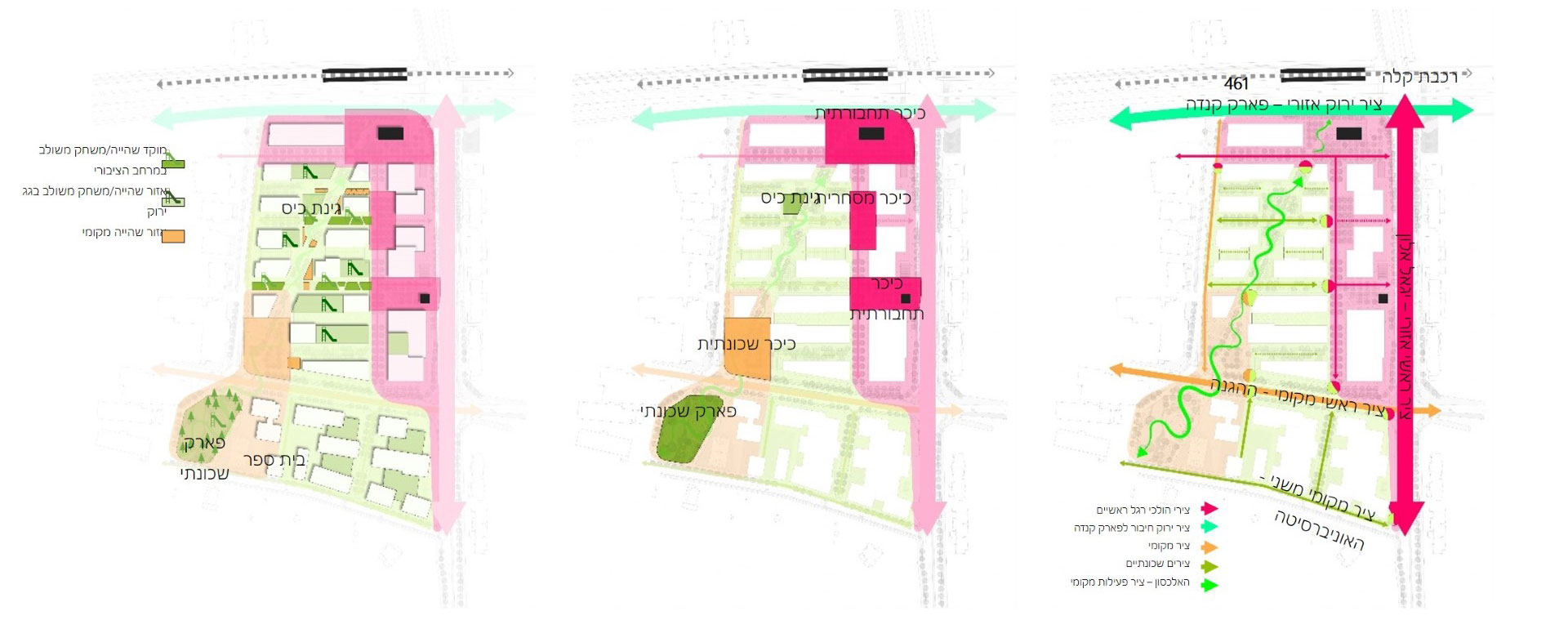
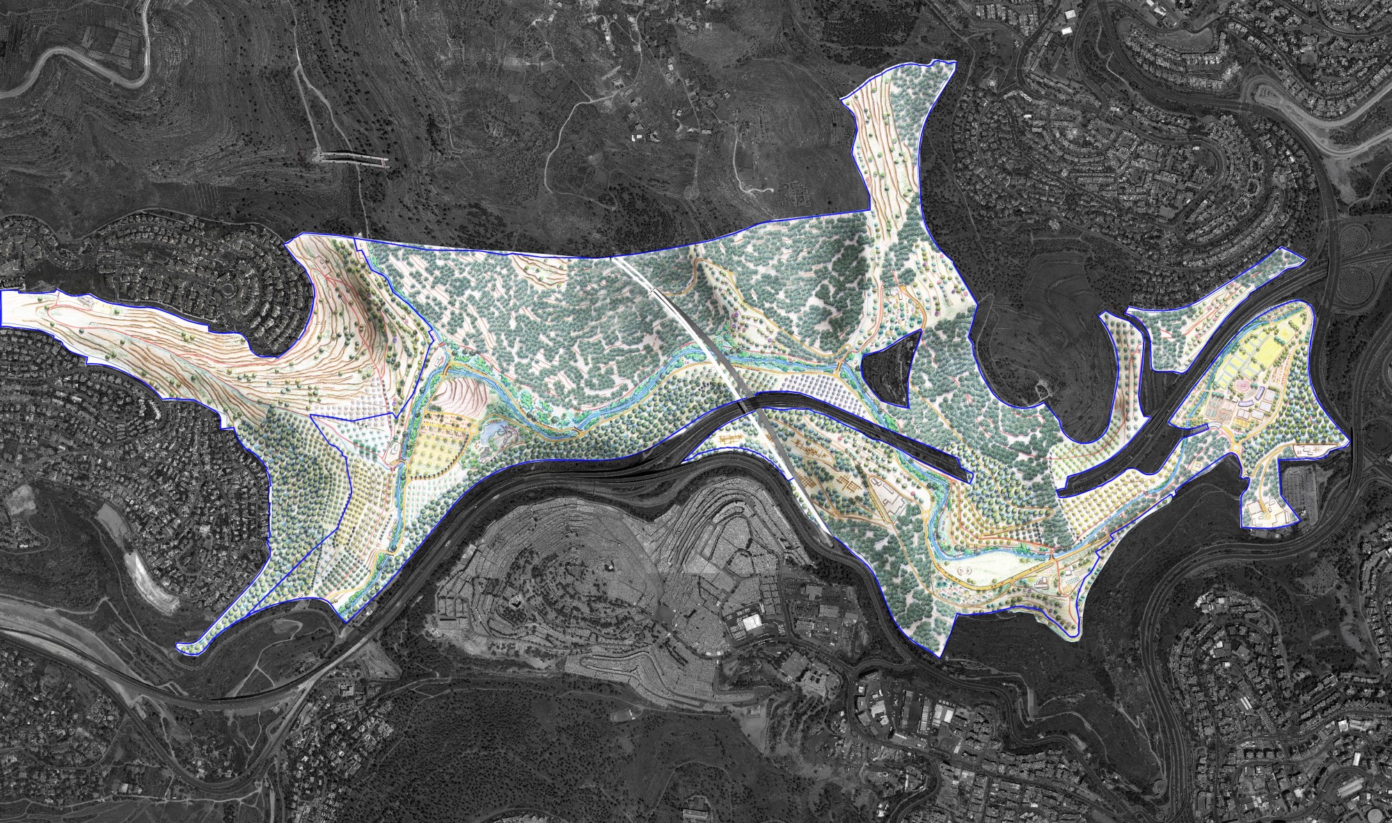
The Ramat Gan Safari

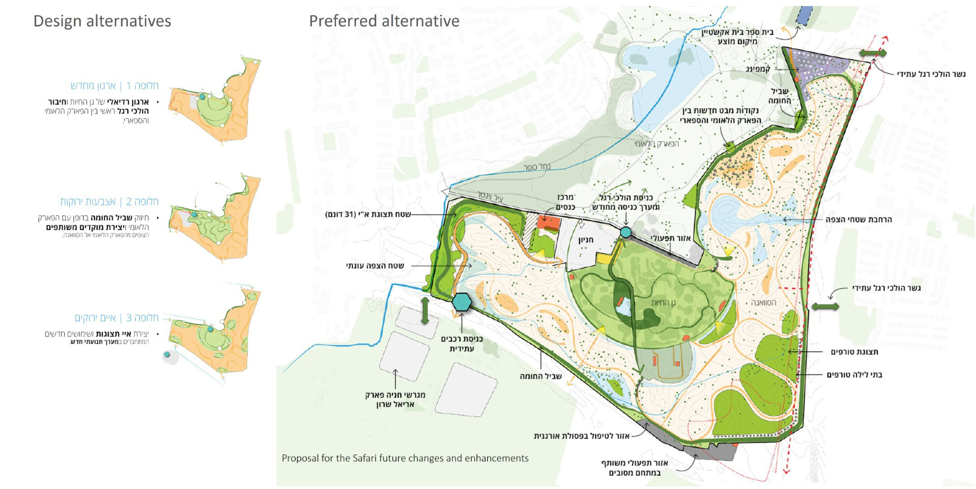
The Ramat Gan Zoological Center ("Ramat Gan Safari") constitutes about 880 dunams of natural space in the Greater Tel Aviv Metropolitan Area. The master plan outlines future development for the safari while addressing local and environmental challenges. The strategic plan outlines the future visitor experience, reorganizing the exhibition spaces and the operational areas. The plan proposes to change the traffic pattern as well as the location of the entrance to the safari area. Along with creating new interfaces between the safari and the surrounding areas, protected areas with great importance for the animals were also identified. A vegetation plan was developed that strengthens the landscape habitat units, uses runoff as a resource and strengthens natural features. The plan is based on existing elements, but provides a comprehensive and long-term vision in light of the safari's growth and development trends. The program supports a variety of development projects currently being advanced at the Safari, from a renewed plan for the entrance gate, through the planning of new exhibition spaces, to the implementation of a walking path project in the savanna that allows for almost direct contact with the animals, as Safari founder Zvi Kirmeyer envisioned. Continuous development of previously open areas, which threatens biological diversity and the existence of natural ecosystems, requires a new line of thought in landscape planning. The plan for the safari looks at this unique place with an innovative perspective and envisions an opportunity to face the challenges of the future while creating a new encounter of humans with nature and animals in the city....

The Pardes District

The development plan for the Pardes district in Or Yehuda is based on convenient access to public transportation, which allows the application of planning principles oriented toward walking, cycling, and public transportation. The district is designed as a dense urban complex centered around a future Metro station and integrates a wide variety of uses including residential, commercial and employment. The public spaces will serve pedestrians and cyclists only, without private vehicles. This enables a wide variety of new activities along the streets, including living areas, play and leisure centers....

Tama 35 National Master Plan

NOP 35 makes the necessary planning provisions to provide for the future development of the state by concentrating future building activities in existing built-up areas. The plan answers to the large demand for additional building space while considering the dwindling land supply. Thus the plan ensures the preservation of the vast majority of open spaces (natural and agricultural) for future generations. The landscape input included the classification of all landscape types in the country; the preparation of design guidelines working toward the protection of existing open spaces and rural areas; the development of green infrastructure corridors with a major north-south green spine that serves as the main structure to organize leading areas of urban and rural development; promotion of environmental sustainability; and the identification and  preservation of landscapes  of particular natural or cultural value....

National Outline Plan for Afforestation

The Jewish National Fund as the managing agency of all forests in Israel requested as statutory plan for the entire country that will define and categorize the borders and types of all existing forests and suggest the development of these and new forests for the years to come. This extensive work started in the 70s but was approved as a statutory document only in 1995. The plan specifies different kinds of forests and assigns to them roles in the overall strategy for afforestation, taking into account natural conditions of climate, type of soil, natural vegetation, and their proximity to human settlements. Care was taken to ensure the continuation and connection between existing and new forests in order to maintain and enhance ecological corridors. The plan was prepared in collaboration with team leader Moti Kaplan and Ilan Beeri....

Emek Haarazim Metropolitan Park

This 3000 dunam park is one of several parks that will form the string of metropolitan parks to surround Jerusalem. The master plan reflects our intention to preserve most of the area in its present state including natural assets and cultural sites. There exists here a great biodiversity of fauna and flora with planted and natural forests, open meadows, traditional agricultural terraces and fields, modern agriculture in form of fruit tree groves, archaeological sites and geological formations, a seasonal river bed that transverses the entire length of the park, and parts of an existing national park. The plan identifies several locations s along the central spine of the park, allowing for recreational activities to take place in defined areas. The park is also one of the main infrastructure corridors to Jerusalem. The successful integration of these into the park was a major concern in the design of the park and road system. Presently the rehabilitation of the river bed with picnic and play areas is under construction, and our office is planning the landscape rehabilitation of several infrastructures including parts of the new train line between Tel Aviv and Jerusalem....